Hydrological Soundscapes
The seasonality of flows in a river is an important part of its identity. Many studies start by displaying a chart similar to the one below to identify high-flow and low-flow seasons at a glance.
The seasonality of flows in a river is an important part of its identity. Many studies start by displaying a chart similar to the one below to identify high-flow and low-flow seasons at a glance.
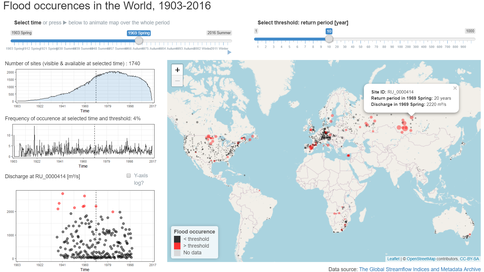
The Global Streamflow Indices and Metadata Archive describes hydrological regimes all over the World. A subset of around 2000 stations over the period 1903-2016 is used in the HEGS project to study floods at the global scale.
In the fun with dendrograms post, a linear dendrogram is gradually bent into a full circle. This transformation isn’t specific to dendrograms and can be applied to any dataset.